
Objective:
Volta River Estates has opted to convert an existing banana plantation into a real estate.
They request for a topographical map with levels and contours of the land with its surroundings so as to enable an appointed planner design a masterplan for the commencement of the land development as well as carry out further design works.
Project Description:
Location: Akosombo, Ghana.
Total Site Area: 49 Ha (approx.)
Total surveyed area: 116ha
Total extracted 3D ground data area: 78Ha
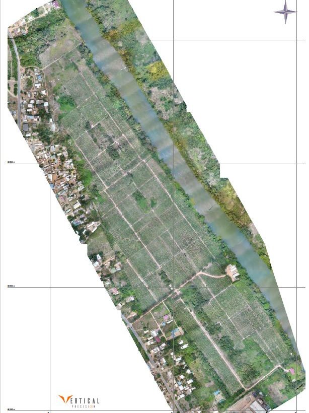
Housing/Estate development is to be located along the Volta River downstream from the Akosombo dam, with utility services, infrastructure and parking facilities.
Scope of survey:
The following deliverables were required:
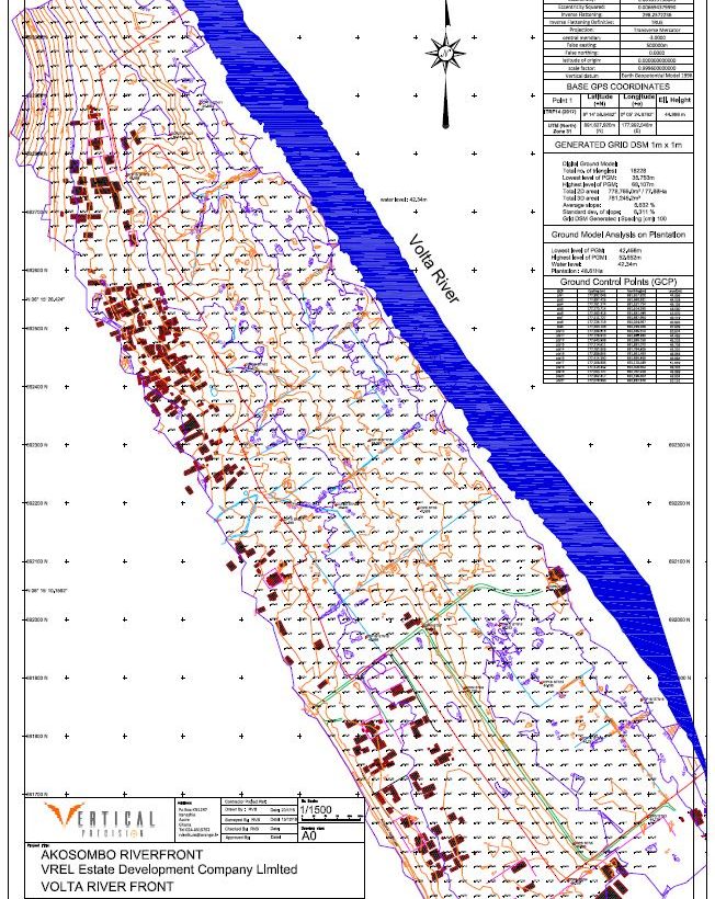
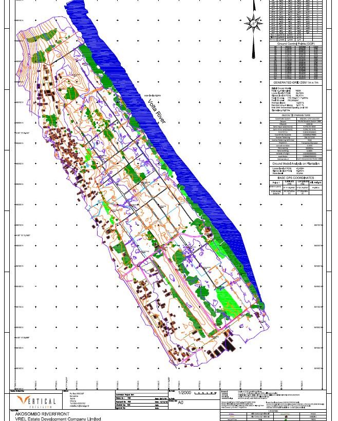
- Production of a grid map of 25m x 25m
- Contour map
- Detailed map with existing features, buildings, roads, utilities and Trees/vegetation
- Longitudinal sections North-south and X sections
- A height discrimination model showing the terrain slopes and water runoff tendency
Methodology:
A Phantom 4 Pro Drone with a 1” sensor was used for image capture
20 GCP (ground control points) were installed and surveyed with a pair of RTK DGPS.
20 targets visible on the imagery at 100m were fabricated and placed on the GCP.
The DGPS loop closure triangulated accuracy with the DGPS was 43mm.
A flight altitude of 100m was selected to provide an average ground sampling of 2.68cm/pixel
The corresponding anticipated accuracy was 5.36cm in northern & eastern, and 8.04cm in height.
All imagery was captured in regular corridors with a 80% longitudinal overlapping and 70% transversal
A total of 1135 images were taken in a pattern of 1745 m x 536m in a multiple flight pattern of 1hour
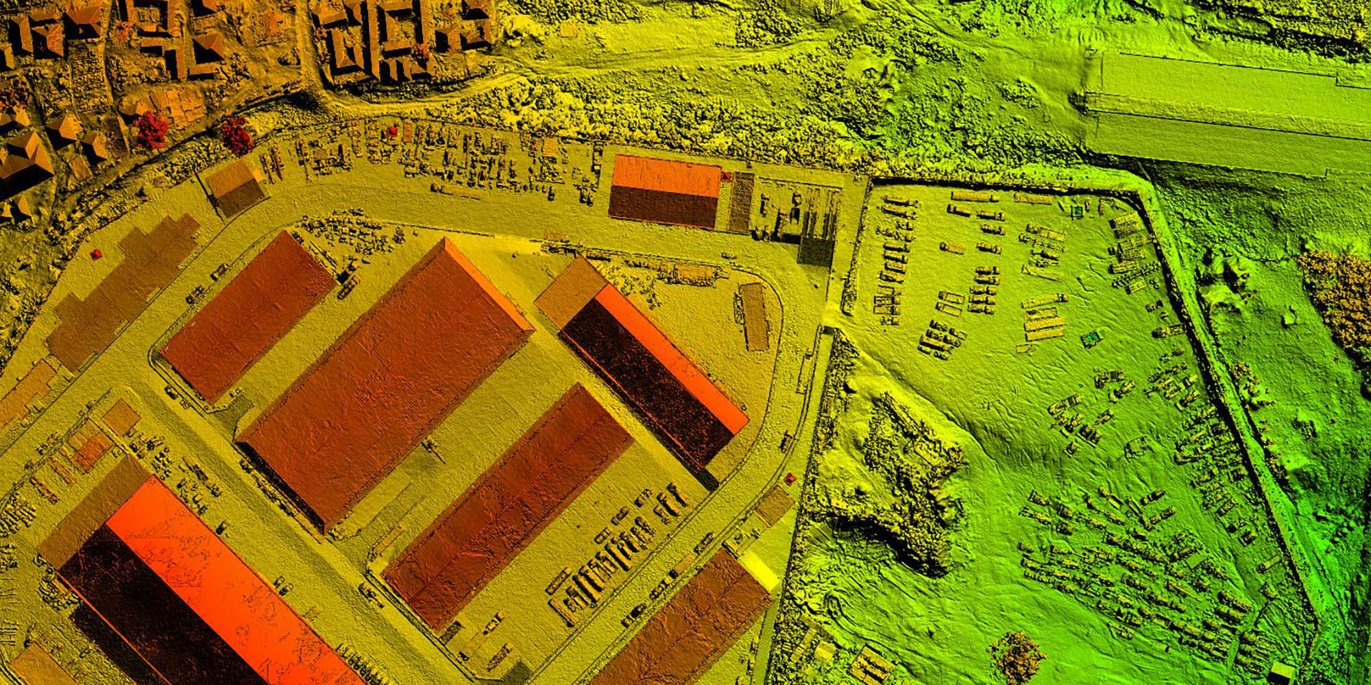
Imagery was processed with a photogrammetric software generating an orthomosaïc and a DSM.
A DTM was generated and a 5m x5m grid levels was extracted.
A GIS software enabled a selective extraction of ground levels below the banana trees, selecting the existing ground and removing interference by the tree canopy and vegetation.
Subsequent data was analyzed with a digital ground modelling software (PDS causeway) and the topographical maps were extracted in ACAD.