Objective:
The planner has consulted Vertical precision to make a general layout of the site, a detailed as-build layout, a detailed topographical map with levels, slopes and contours including all site features.
Trees, powerlines, drainage, sewerage lines to the treatment plant are to be incorporated.
Project Description:
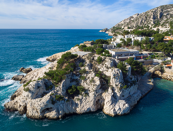
In the middle of the Côte Bleue, the Niolon cove is located between l’Estaque and Carry le Rouet.
The renowned diving center also occupies a former military fort. The view is also remarkable over the whole bay of Marseille and Friuli. A small path accessible from the port allows people to climb up the cliff to have a better view of the Niolon bay.
The facilities of the diving center, bungalows and accommodation serving the school are aging and deteriorated over the years. The owner of the center has contracted a planner to design a new bungalow scheme whereby the existing one is to be demolished.
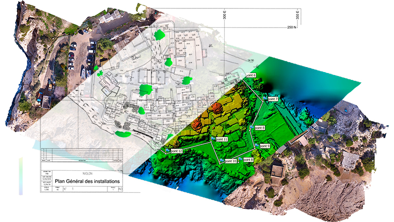
The site was hilly and the terrain was steep with 12m deference between the lower section and upper part
Total surveyed area: 12 ha
Scope of survey:
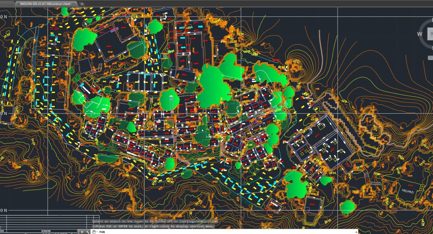
The following deliverables were required:
- Plan,
- Detailed map with existing features, buildings, roads, utilities and Trees/vegetation
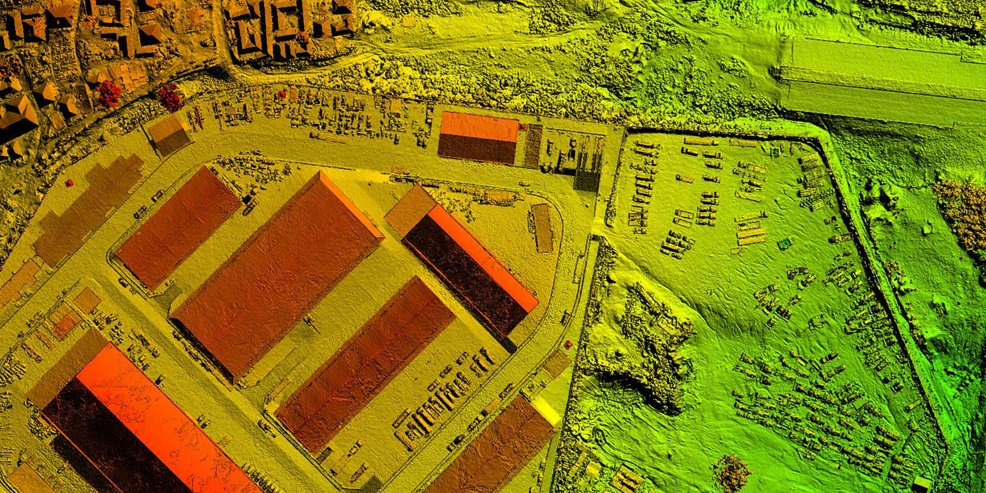
- Orthophoto @ 1 cm/pixel resolution
- 3D textured model
- Photo and 360 aerial view