
Context
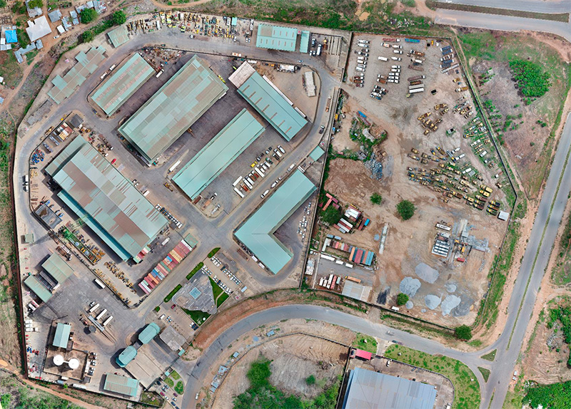
Industrial Depot complex of Setraco Nigeria limited constructed in 2012 composed of:
- Central workshop heavy construction equipment
- Central workshop Trucks, overhaul and repair
- Heavy Duty overhaul engines
- Undercarriage, Tracks
- Hydraulics
- Panel beating
- Vulcanising section
- Light Duty, vehicles repair and overhaul.
- Central stores spare parts
- Fuel storage
- Washing bays
- Administration offices to run complex
- Storage of used construction equipment.
The complex is to serve all construction sites of all states in Nigeria.
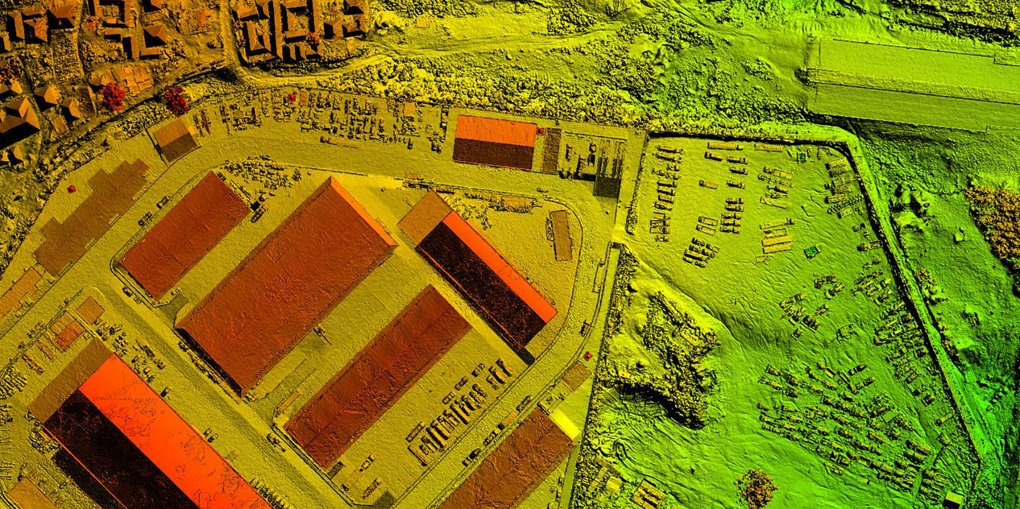
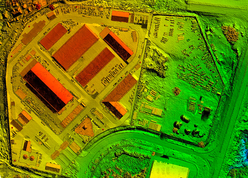
The purpose of the capture is to provide an as-build layout of premises. It highlights eventual neighbor encroachments or drainage issues.
The as- build varies from the design drawings and changes need to highlighted be recorded.
Existing roof areas, road levels, drainage levels, utilities services are extracted necessary for maintenance.
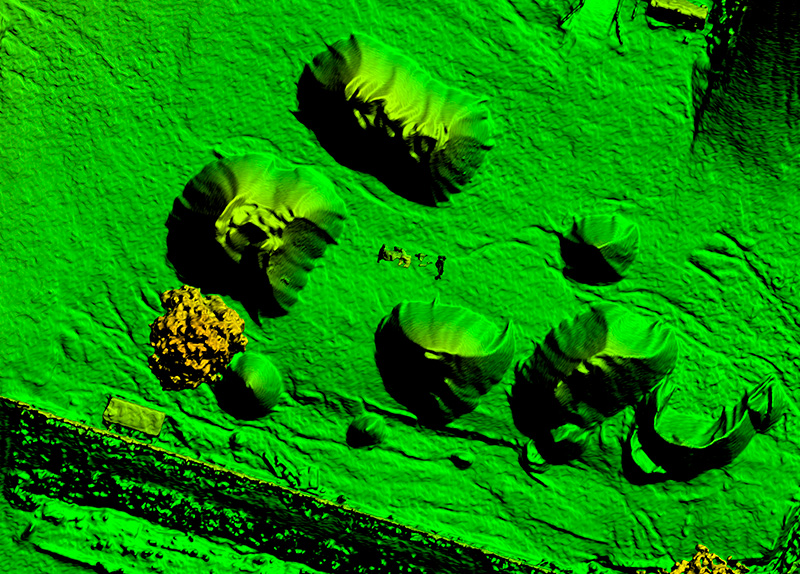
The adjacent area were scraped construction equipment is stored was captured to extract topographical ground levels for future extension Phase 2.
Completed:
October 2018
Location:
IDU Yard Abuja – Nigeria
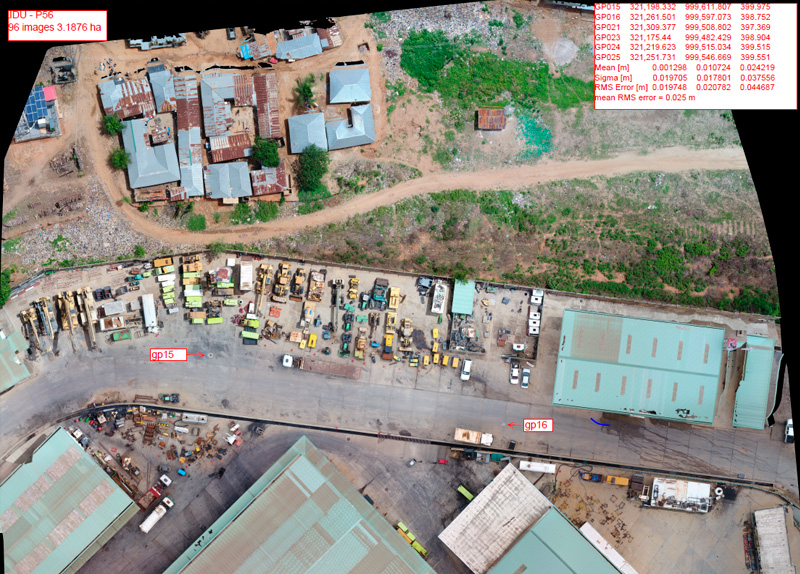
Capture methodology
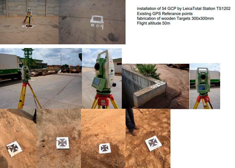
50 GCP ground control points were installed using a total station Leica TS06 referenced on existing GPS beacons.
The Drone capture was done at an altitude of 50m to provide accuracy in safe mode. As follows the Drone stops at each images, and the flight mission is limited to 99images/flight.
12 different flights with overlapping were necessary to cover the entire area. The merging of the 12 imagery captures formed one orthomosaïque with a total of 1137images.
The total area is 23.73ha. The Average ground sampling distance (GSD) reported is 1.44cmpixel and the Georeferancing RMS error is 19mm.
The corresponding accuracy X/Y is 2.88cm and 4.32cm in elevation.